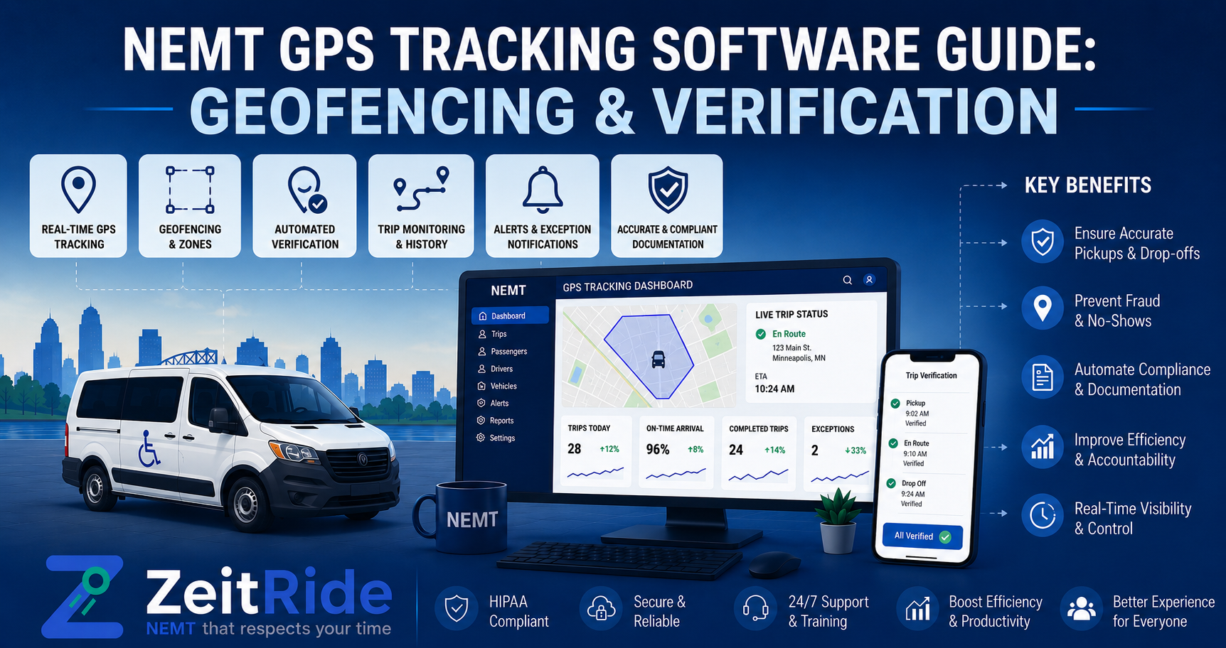
NEMT GPS Tracking Software Guide: Geofencing & Verification
Learn how NEMT GPS tracking software connects live vehicle visibility, geofencing, timestamps, and trip verification for cleaner NEMT operations.
Quick answer
NEMT GPS tracking software shows vehicle locations in real time and connects GPS data with trip status, timestamps, geofencing, dispatch, and proof-of-service records so providers can manage active trips and verify what happened.
ZeitRide Team
NEMT Operations Expert
For an NEMT dispatcher, seeing a vehicle as a dot on a map is useful—but it is only the beginning. The real value of NEMT GPS tracking software appears when that location is connected to the trip the driver is actually performing: the scheduled rider, pickup window, stop status, pickup and drop-off times, route history, and the records your team may need later.
A generic fleet tracker can tell you where a vehicle is. NEMT software should help explain what that vehicle is doing there and what happened during the trip. If your team is evaluating real-time NEMT vehicle tracking, focus on whether the tracking system connects location with trips, drivers, stops, statuses, and documentation rather than judging it only by how quickly a map marker refreshes.
What Is NEMT GPS Tracking Software?
NEMT GPS tracking software is transportation software that records and displays vehicle location data while connecting that information to non-emergency medical transportation trips. A well-designed system can give dispatchers live fleet visibility while preserving location history, pickup and drop-off timestamps, driver activity, and other trip-specific records.
That connection matters because NEMT operations are different from general delivery or service fleets. A dispatcher does not only need to know that a vehicle is on Main Street. The dispatcher may need to know which member is assigned, which facility is next, whether the driver has arrived, whether the pickup window is at risk, and whether the completed trip record contains the information required by the applicable payer or broker.
| Capability | Generic GPS Tracker | NEMT GPS Tracking Software |
|---|---|---|
| Current vehicle location | Yes | Yes |
| Driver identity | Usually | Yes |
| Assigned NEMT trip | Usually no | Yes |
| Rider/trip context | No | Yes |
| Pickup and drop-off status | No | Yes |
| GPS-linked timestamps | Limited | Trip-specific |
| Geofencing | Sometimes | Can be tied to NEMT stops |
| Historical route playback | Often | Can be tied to completed trips |
| Driver workflow | Limited | Connected to trip execution |
| Trip verification support | Limited | Can support documentation workflows |
| Dispatch integration | Basic or separate | Core workflow |
| Billing/documentation connection | Usually no | Possible within connected platforms |
How Does Real-Time GPS Tracking for NEMT Work?
The exact technical workflow varies by platform, but real-time GPS tracking for NEMT generally combines location data from the driver's device or vehicle with the trip information held in the transportation platform.
The important difference is context. GPS coordinates become operationally useful when the system knows which driver, vehicle, route, member, and stop those coordinates belong to.
- A trip is scheduled or imported and assigned to a driver and vehicle.
- The driver's mobile workflow connects that assignment with location reporting.
- GPS coordinates and time data are associated with the active trip.
- Dispatch sees the vehicle's position alongside route and trip status.
- Arrival, pickup, drop-off, no-show, or other events can be recorded during execution.
- Geofences can help identify when a vehicle enters or leaves a defined location.
- Completed-trip records preserve relevant timestamps and location history.
- The operational record can later support customer service, reporting, billing review, or trip verification.
This is why GPS is most useful when it is part of NEMT dispatch software. Location without dispatch context answers "Where is the vehicle?" Connected tracking helps answer the more valuable question: "What is happening with this trip right now?"
What Should Dispatchers See on a Live NEMT Fleet Map?
A live map should reduce uncertainty, not create another screen dispatchers have to interpret. The most useful NEMT tracking views combine location with operational context so staff can recognize delays and exceptions before they turn into missed pickups.
- Current vehicle location
- Assigned driver
- Active trip or route
- Current trip status
- Next scheduled stop
- Scheduled pickup or appointment window
- Recent pickup and drop-off activity
- Vehicles that appear late or off route
- Available vehicles near an unassigned trip
- Last known location if connectivity is interrupted
The best tracking workflow reduces the need for dispatchers to repeatedly call drivers asking where they are, whether they reached a facility, or whether a passenger has already been picked up.
How Does NEMT Geofencing Work?
NEMT geofencing uses a virtual geographic boundary around a meaningful location—such as a member pickup address, dialysis center, hospital, or other facility. When the tracked device enters or leaves that boundary, the software can use the event as part of the trip workflow.
A geofence does not automatically prove that a passenger entered or exited the vehicle. Instead, it provides location context that can strengthen other trip information such as timestamps, driver status, signatures, or passenger verification.
Practical NEMT Geofencing Example
Imagine a driver has a 10:00 a.m. pickup at a dialysis center. The system has a geofence around the facility. When the driver's device enters that area, the platform can record the location event. The driver may then mark "arrived," complete the pickup workflow, and later record departure. Together, those events create a clearer sequence than a manually entered time at the end of the day.
Geofencing is increasingly appearing in real transportation-program technology. For example, Montana Medicaid NEMT program materials describe digital ride tracking and appointment confirmation through geofencing. Requirements still vary by program, payer, broker, and contract, so providers should not assume one state's workflow applies nationally.
How Does NEMT GPS Trip Verification Work?
NEMT GPS trip verification uses location and time information as evidence supporting what happened during a transportation service. GPS becomes more meaningful when it is linked to the specific trip rather than stored as an isolated vehicle trace.
Industry guidance provides a useful framework. The NEMTAC passenger verification standard describes the use of GPS equipment or mobile applications connected with NEMT trip software. It also identifies recorded time plus corresponding GPS coordinates as a method for supporting trip verification, with stronger verification models combining GPS with a unique identifier or another method of confirming passenger presence.
That does not mean GPS alone satisfies every Medicaid, broker, payer, or state requirement. Providers should keep GPS in context with broader NEMT documentation requirements, because location data does not independently prove every element of a billable service.
| Question | Can GPS Help? | Is GPS Alone Enough? |
|---|---|---|
| Was the tracked vehicle at a location? | Yes | Often strong location evidence |
| When was the vehicle there? | Yes | Timestamp improves evidence |
| What route did the vehicle travel? | Yes | Historical data can help |
| Which rider was transported? | Indirectly | No |
| Was the transportation authorized? | No | No |
| Was the correct service level delivered? | No | No |
| Was the passenger physically present? | Indirectly | Not necessarily |
| Was a required signature captured? | No | No |
| Is the trip automatically payable? | No | No |
GPS Tracking vs. Route Optimization: What Is the Difference?
GPS tracking and route optimization solve related but different problems. GPS tracking tells you where a vehicle is or where it has been. Route optimization helps decide where that vehicle should go and in what sequence.
A tracking system may reveal that a driver is behind schedule. Routing software can help determine whether a stop sequence or reassignment should change because of that delay. When the two functions are connected, live trip information can support better operational decisions. Providers evaluating the routing side separately can review ZeitRide's NEMT routing software.
What Happens When a Driver Loses Cell Service?
GPS and cellular connectivity are related, but they are not the same thing. A phone may still be able to determine its location from satellite GPS even when cellular data is weak or unavailable. The challenge is transmitting that information back to dispatch in real time.
For NEMT providers operating rural routes, large facilities, parking garages, or other low-connectivity areas, offline GPS for NEMT can matter almost as much as live tracking.
A good offline workflow should preserve relevant trip and location information locally and synchronize it after connectivity returns. Dispatch should also understand that "offline GPS" does not necessarily mean the office can see a continuously updating live location while the device has no data connection.
The ZeitRide Driver App is built with offline GPS support so drivers can keep their route workflow available during connectivity gaps and synchronize updates when service returns.
What Should You Look for in NEMT GPS Tracking Software?
The right tracking system depends on your operating model, broker requirements, geography, and existing software stack. Rather than asking only whether a vendor "has GPS," evaluate how completely tracking fits into the trip lifecycle.
- Real-time fleet visibility
- Trip-linked GPS records
- Clear driver and vehicle identification
- Pickup and drop-off timestamps
- Geofencing capabilities
- Historical route playback
- Offline data capture and later synchronization
- Driver mobile workflow
- Dispatch integration
- Route and stop status visibility
- Searchable completed-trip history
- Exportable records where needed
- Role-based access and security controls
- Clear data-retention policies
- Support for the documentation requirements that apply to your payers and brokers
Questions to Ask During a GPS Software Demo
Instead of watching a prepared dashboard, ask the vendor to run one realistic trip and show the entire tracking workflow.
- Where does the driver appear before the trip starts?
- How is the trip assigned?
- How often does the dispatcher view update?
- What happens when the driver arrives at pickup?
- What data is recorded at pickup and drop-off?
- How does geofencing behave?
- What happens if the phone loses connectivity?
- How is historical route data retrieved?
- What does the completed trip record look like?
- How does GPS data connect with documentation or billing workflows?
Testing one complete workflow is often more revealing than comparing long feature checklists. You want to know whether the tracking data actually follows the trip from assignment through completion.
How ZeitRide Connects GPS Tracking to NEMT Operations
ZeitRide treats GPS as part of the operating workflow rather than as a separate fleet map. Its platform connects real-time vehicle visibility, geofencing, historical route data, live stop tracking, and offline GPS with the trips dispatchers and drivers are already managing.
The ZeitRide Driver App connects trip assignments, navigation, pickup and drop-off statuses, timestamps, forms, and e-signatures with the same operating system dispatch uses. That means the value of tracking is not simply that a dispatcher can see a moving vehicle. The goal is to keep location, trip execution, driver activity, and completed-trip history connected.
A GPS Dot Is Only Useful When It Has Trip Context
For an NEMT provider, the best GPS tracking system is not necessarily the one with the most detailed map. It is the one that helps your team make faster decisions during the day and produces a clearer record afterward.
NEMT GPS tracking software should connect vehicle location with the driver, assigned trip, stop status, timestamps, geofencing events, and relevant trip documentation. That connection is what turns GPS from passive fleet monitoring into an operational tool.
If you are evaluating a new platform, bring one real route and test the full workflow instead of watching a generic demo. You can talk to the ZeitRide team and see how a live trip moves from driver assignment through tracking and completion.
See GPS Tracking on a Real NEMT Route
Do not evaluate tracking from screenshots. Bring one real route, a driver workflow, and the questions your dispatch team deals with every day. ZeitRide can show how live fleet visibility, trip statuses, offline GPS, and completed-trip history fit together inside the same NEMT operation.
Ready to see the workflow with your own routes? See how ZeitRide works with your routes and evaluate the tracking experience using a real NEMT trip.
Frequently Asked Questions
Q: What is NEMT GPS tracking software?
NEMT GPS tracking software monitors vehicle location while connecting GPS data to NEMT trips, drivers, stops, timestamps, and dispatch activity. Unlike a standalone fleet tracker, it can preserve trip-specific context for live operations and completed-trip records.
Q: Is GPS tracking required for every NEMT provider?
No single GPS requirement applies universally to every U.S. NEMT provider. Requirements can differ by state Medicaid program, managed-care organization, broker, payer, service type, and contract. Providers should verify the rules that apply to their specific trips.
Q: What is NEMT geofencing?
NEMT geofencing creates a virtual boundary around locations such as pickup addresses or medical facilities. Entering or leaving the boundary can provide location context for arrival, departure, timestamp, or verification workflows.
Q: Can NEMT GPS tracking work without cell service?
A mobile device may continue receiving GPS location data without cellular service, but real-time transmission to dispatch may stop until connectivity returns. Offline-capable software can preserve relevant data locally and synchronize it later.
Q: What information is useful for NEMT GPS trip verification?
Useful trip-verification information can include GPS coordinates, timestamps, vehicle and driver identification, pickup and drop-off events, signatures or attestations where required, and other trip-specific documentation. Exact requirements vary.
Q: What is the difference between GPS tracking and route optimization?
GPS tracking shows where a vehicle is or has been. Route optimization determines how trips and stops should be sequenced. Connected NEMT software can use both so dispatchers see current execution while managing the planned route.
Rather see it than read about it?
Bring a real route, a couple of drivers, and your current process. 15 minutes, zero pitch.